

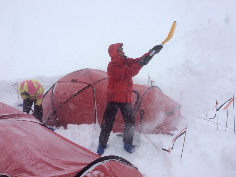
The plateau. Despite the innocuous name, by the time we’d settled in to camp 4 it had acquired all the menace of Mordor. The Prospector col, the point of entry which sat just 250 metres above us, was the gateway into that frozen hell. The question rebounding slowly between our two tents as we cowered under an onslaught of wind and snow, was whether we were prepared to pass through that gate.
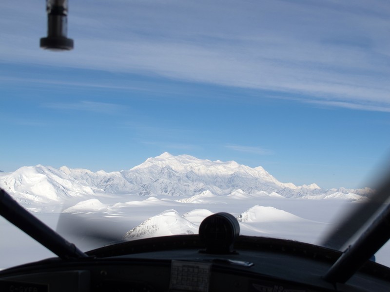
Mount Logan is not one of world’s iconic mountains. The Canadians we met seemed unaware that it is the highest peak in their country, and the second highest in North America. Our first sighting came from the window of a Helio Courier, a sardine can of a wheel/ski plane that can carry two passengers and kit per flight, all weighed beforehand. With a distance of some 100 miles to cover, we had time to boggle at the vast glaciers, flowing down from the biggest icefield in the world, outside of the polar regions.
We flew alongside the enormous slab of mountain, the highest point barely distinguishable from other peaks on the massif. The plateau towered over us at 5000 metres, with its notoriously complex ridges tumbling down the sheer sides. The plane swung round the end of the massif and our route – the Kings Trench – slid into view. It is as prosaic as it sounds, a long snow ramp hemmed in by high ridges, the only reasonably easy access to the plateau.
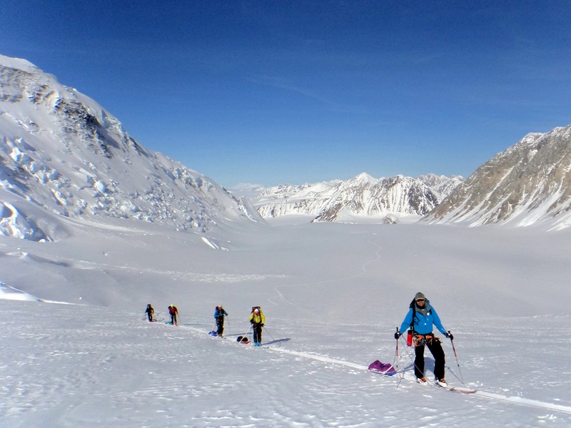
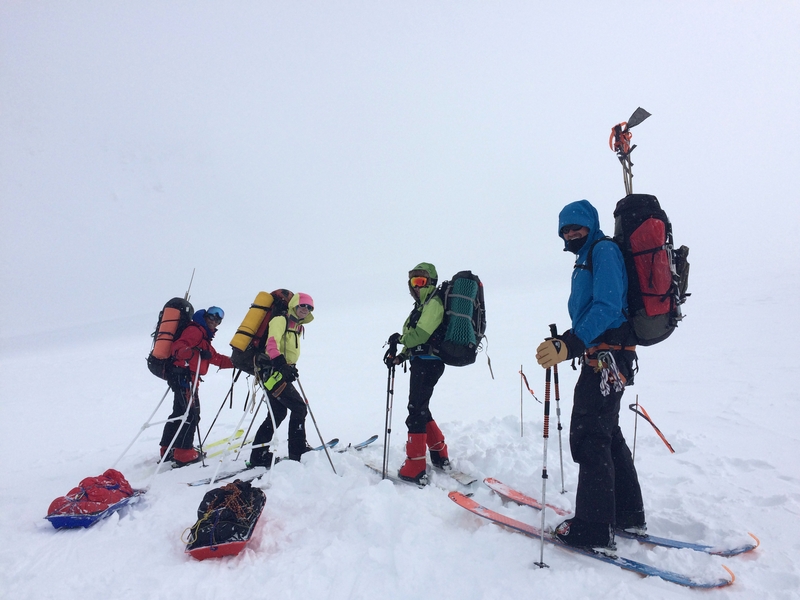
Logan may be immensely broad, the largest non-volcanic mountain massif in the world, but that doesn’t mean it’s small. We faced a 3,200 metre climb and given the distance, the height, the fickle weather and the need to acclimatise, we had to move double loads. We would carry food and fuel to the site of the next camp, bury it in the snow, and ski back down. The next day (or when weather allowed) we’d pack up camp and move it all up to the cache.
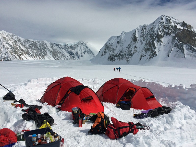
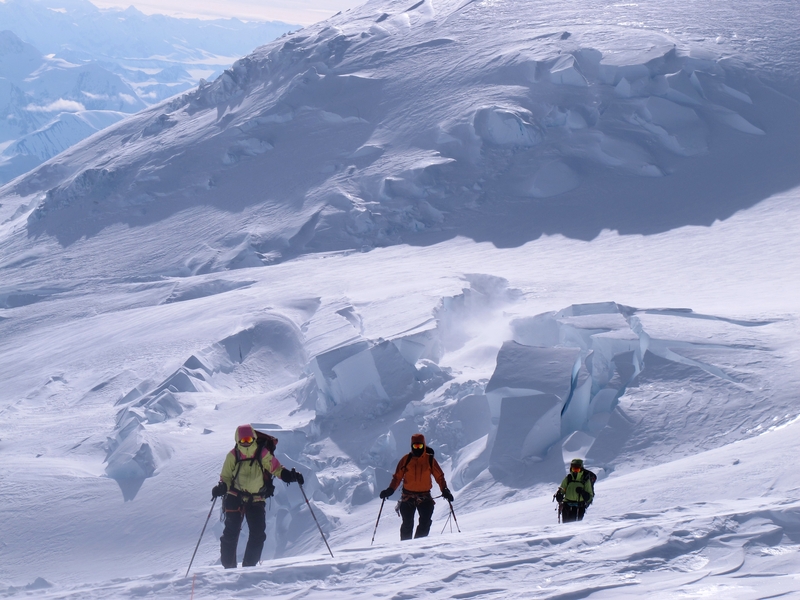
Two camps got us to the Kings Col at 4,100 metres, where the trench swings left and suddenly rears up in a short icefall. Teams ahead of us had already found a way through and a heavy snow year meant the crevasses were well covered. We were becoming adept at cutting blocks of snow to build walls to protect our tents from wind. The icefall featured the same clean-cut blocks, only this time the size of small apartment blocks, with crevasses between them that dropped down through ever-deepening shades of blue into inky darkness. We did three carries through the icefall, the terrain was too steep to battle with towing a sled. Each time we slid gingerly, breath held, under a vast curling wave of snow like the edge of a gigantic shell.

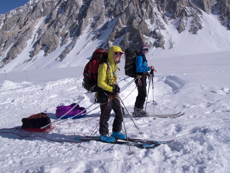

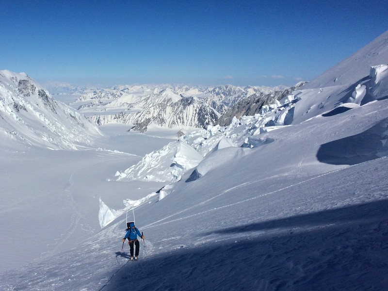

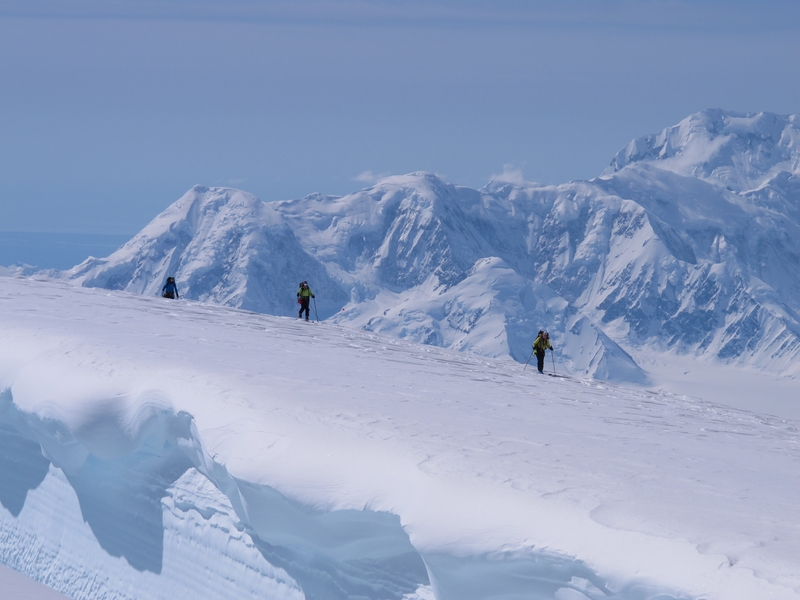
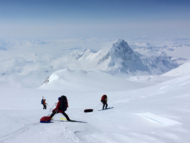
Above the icefall the angle eased a little. We used the sleds again, but now they hung behind us like sulky deadweights, sliding sideways on every zig-zag. We climbed up to the camp 3 on a day of relentless heat, I felt slower and weaker with each shuffle of a ski, my sled a recalcitrant demon from the lower reaches of hell. The reward that made it all worthwhile was the opening of the view, across the broad Seward glacier to the picturesque Mount Saint Elias and the Pacific ocean beyond. The glaciers were so vast they looked like a cloudscape seen from above, with the mountains poking through.
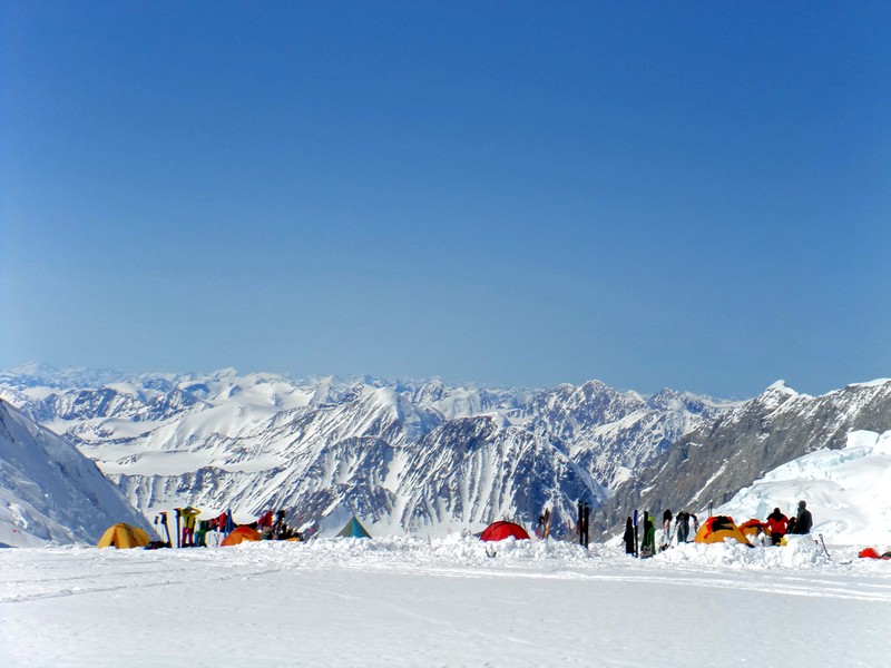
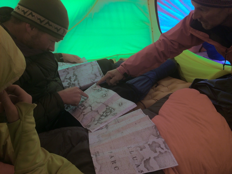
By the time we were huddled together in camp 4 (5245m) we had already covered over 18 kilometres (60 kms with the repeat carries). We peered at our sketchy topo maps, contemplating the sad truth that the Kings Trench dumped us at the wrong end of the notorious plateau. Calling it a plateau doesn’t do it justice. We needed to drop down 500 vertical metres from the col, and travel 12 kilometres to the summit while climbing up over 800 vertical metres. The coldest temperature ever recorded outside of Antarctica was observed on the plateau of Logan, -77.5 °C late in the month of May.
Part of the attraction of Logan is that even the non-technical Kings Trench route does not have a very high success rate, or many ascents. Denali now hosts over a thousand climbers each year, while Logan still has less than hundred.
As we’d dug ourselves a tent platform, we had watched two demoralised teams ski down past us. One local team, who had taken it very slowly due to three past failures, finally ran out of motivation. Then a pair of Austrians staggered into view over the notorious col, exhausted and disheartened after three days of bad weather and illness on the plateau.
We’d already benefited from the failure of yet another team, stopped by altitude sickness. They had bequeathed us an impressive cache of food and fuel, conveniently left at 4800 metres. It had included an array of expensive cheeses from the Whitehorse deli.
We were lucky enough to have a meteo professional from Vancouver supplying custom weather reports, received on our Delorme Inreaches (a two-way satellite text device). We wanted as a three-day window but a series of fronts were passing by, making the weather unsettled and very hard to forecast.
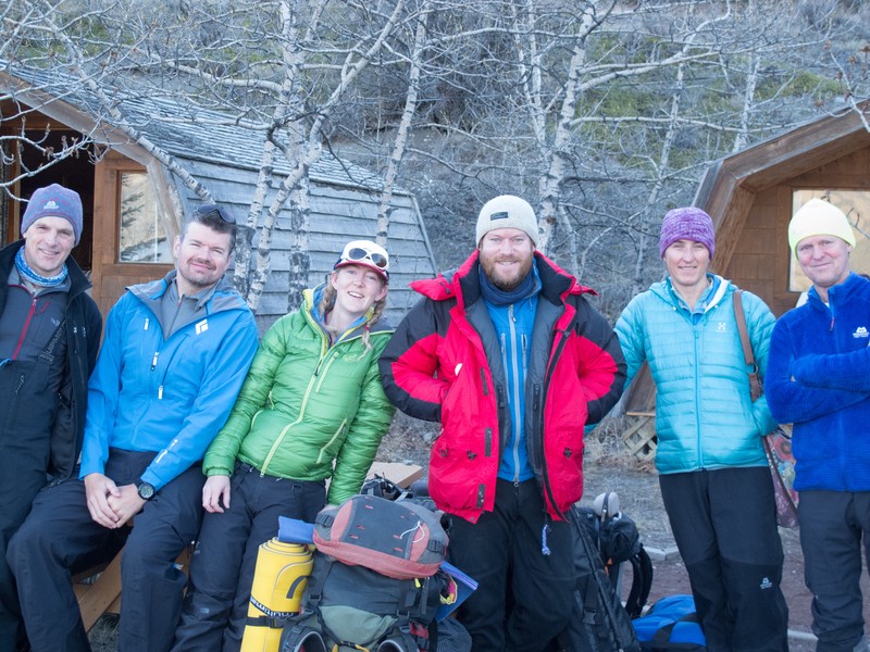
We’d had a team meeting while still safely down on the valley floor, and everyone was here to have a good time and come home safely. We all agreed, given the exposed nature of the plateau and the difficulty of exiting from it, that we’d only venture up there in reasonable weather.
However, as we waited and debated in camp 4, it become apparent that we didn’t all mean the same thing by ‘reasonable’. For Phil, reasonable meant perfect – no wind, blue skies – and with no sign of any such window, he wanted to go down. For others of us, buoyed by our success in getting this far, resignedly accepting that no ideal weather window lay in our future, reasonable expanded to mean whatever wasn’t awful.
We had all come a long way and invested a lot of time, money and effort, giving up other things to do this. We were climbing with two three-man tents, two GPSs, two Inreaches, two stoves. We had the capacity to split the team but one person could not safely descend on their own. Finally Chris, tired of cold and altitude, decided to go down as well.
The rest of us pushed quickly up and over the col, making use of a slender gap of better weather. Mordor opened up to us with a pleasant ski down into a low bowl, deceptively benign in a gentle wash of sunshine.


Exasperated with lugging loads, we camped early at the base of the direct line to the West Peak of Logan. A 4am alarm had us on the move by 7am. With four people squeezed into the three-man tent, there was little room to manoeuvre.
A clear dawn greeted us but the forecast predicted clouds moving in around 1pm. We were racing the weather to the summit, just racing very slowly. The winds rose as we shuffled our way higher. By the time we dumped our skis at 5850m and swopped to crampons, the mist had enveloped us. We trudged along the narrow ridge to the top at 5959 metres, buffeted by ever stronger winds, catching just the barest glimpses of the last few metres of the notorious Hummingbird ridge. It was a frustrating summit, without views, too cold to stay long – a poor recompense for the many days of work.
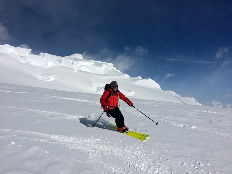
Once back on our skis, we found the cloud had swallowed up all signs of our track, the slope, and the mountain. Progress slowed to a wobbly snow-plough, the GPS used to work out a bearing along our up track, the compass used to follow that bearing. The hard-edge, ice-topped sastrugi, undetectable in the greyness, caught at ski edges poorly controlled by thighs shaking with fatigue. And then we faced a heart-breaking 200 metre climb over two kilometres, peering wishfully into the mist, convinced every shadow must be our camp. We collapsed into our tent nearly twelve hours after we left.
The next morning’s climb back to the col was tortuous. To say it was only 300 vertical metres over three kilometres does not begin to do it justice. Finally it ended and we fled back over the col, escaping safely through the gates of hell and making sure not to look back.
Joint ESC-ASC expedition
Dates on mountain: 8 to 27 May 2016


