

The goal: the SE ridge of Mount Steele 5073m, a peak in the Kluane National Park in the Yukon, Canada.
9 May – 2 June 2019
Six members set out to climb and ski Mt Steele (5073m), in the Kluane National Park in the Canadian Yukon. Despite poor weather and open crevasses, the team covered the 10 miles to the foot of Steele, but were stopped by blue ice on the final 1000m face of the peak.
This article was written by team member Susie Amann for the Eagle Ski Club journal
‘Better than Logan!’ These unexpected words were uttered by Cathy O’Dowd, the only team member who had been to the Yukon before. ‘Better how?’ we asked, and the answer came in the form of the undeniably impressive vistas, from the seemingly endlessly stretching peaks in all directions to the vast, hideously crevassed and impassable glaciers we looked down upon. ‘On Logan, you’re in a big trench all the time, you just don’t see this’.
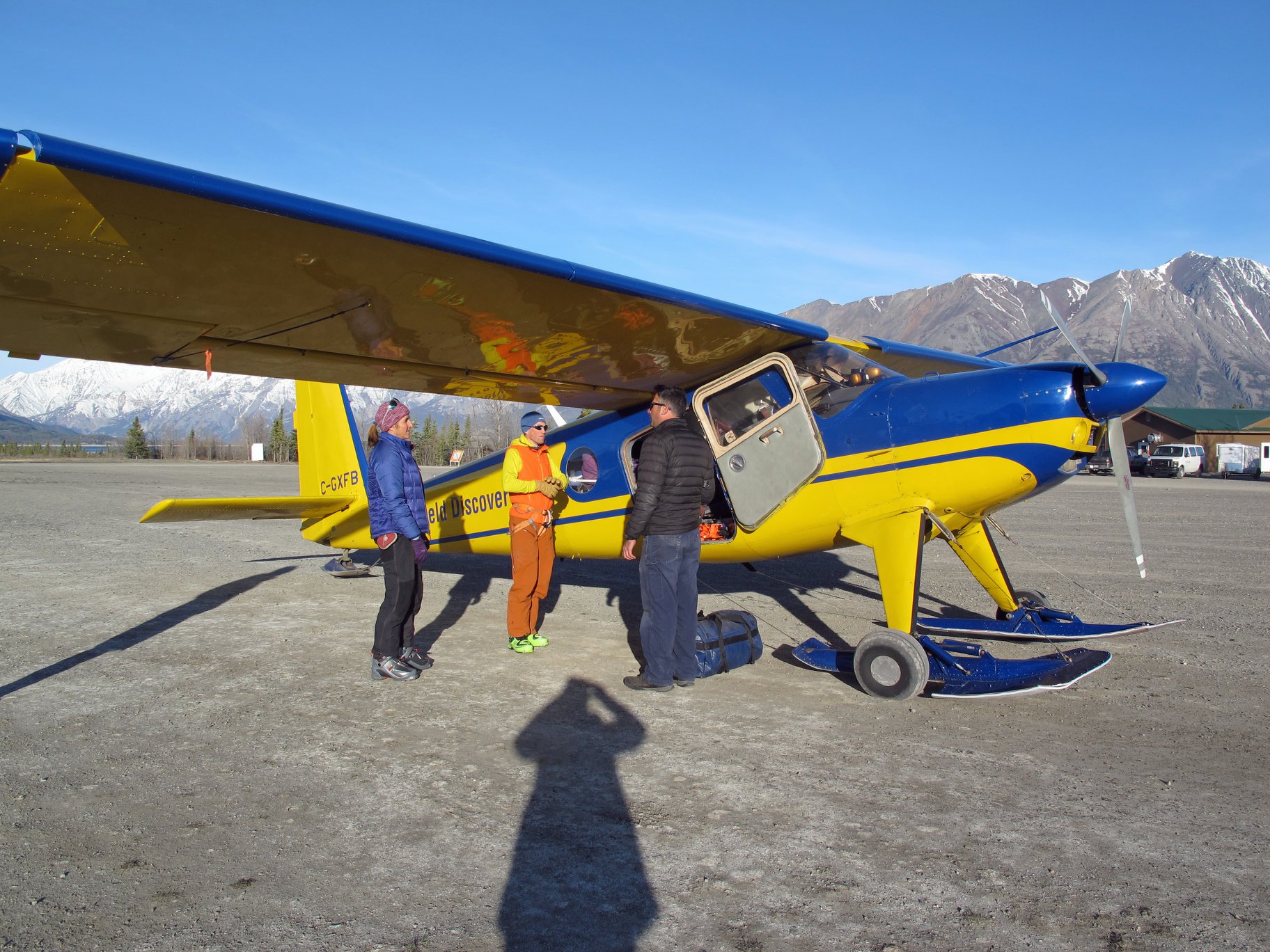
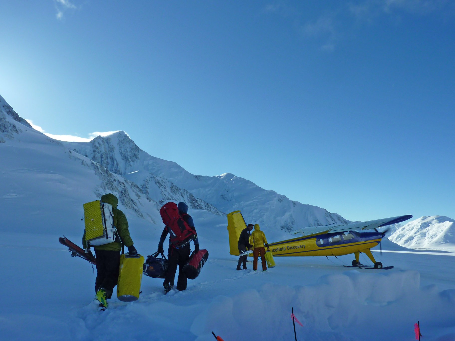
The Yukon has a reputation for bad weather, so we couldn’t believe our luck when we arrived to find blue skies and a good forecast for several days. Others had not been so lucky and there was a backup with flights so we whiled away the balmy afternoon by Kluane Lake, impatient to get going, but accepting that waiting for flights is all part of the experience. The following morning, the team of six was flown in by Icefield Discovery, two at a time, landing close to the Steele/Walsh col (3150m) which is at the altitude limit for these planes. This drop-off point was approximately 10 miles/16km from Mt Steele (5073m), first climbed by Bradford Washburn in 1937. Mt Steele was our main objective, with Mt Lucania as an ambition if everything went right.
Having established camp, we revelled in the comfortable tents ‘Hey, look, I can stand up!’ and began the important matter of acclimatisation by drinking many brews, and doing lots of digging. Brewing and digging were to be some of our most important occupations, while we looked around at the serac- and ice-laden slopes around us, and wondering if we were going to be able to get up anything.
The following day we tackled Mt Jedken (3756m): a straightforward if steep ascent. There was a moment of drama on the descent when Jack stopped to retrieve a wand marking the route only to find that we had unintentionally also marked a crevasse, as the bridge gave way beneath him. A swiftly deployed rope resolved that.
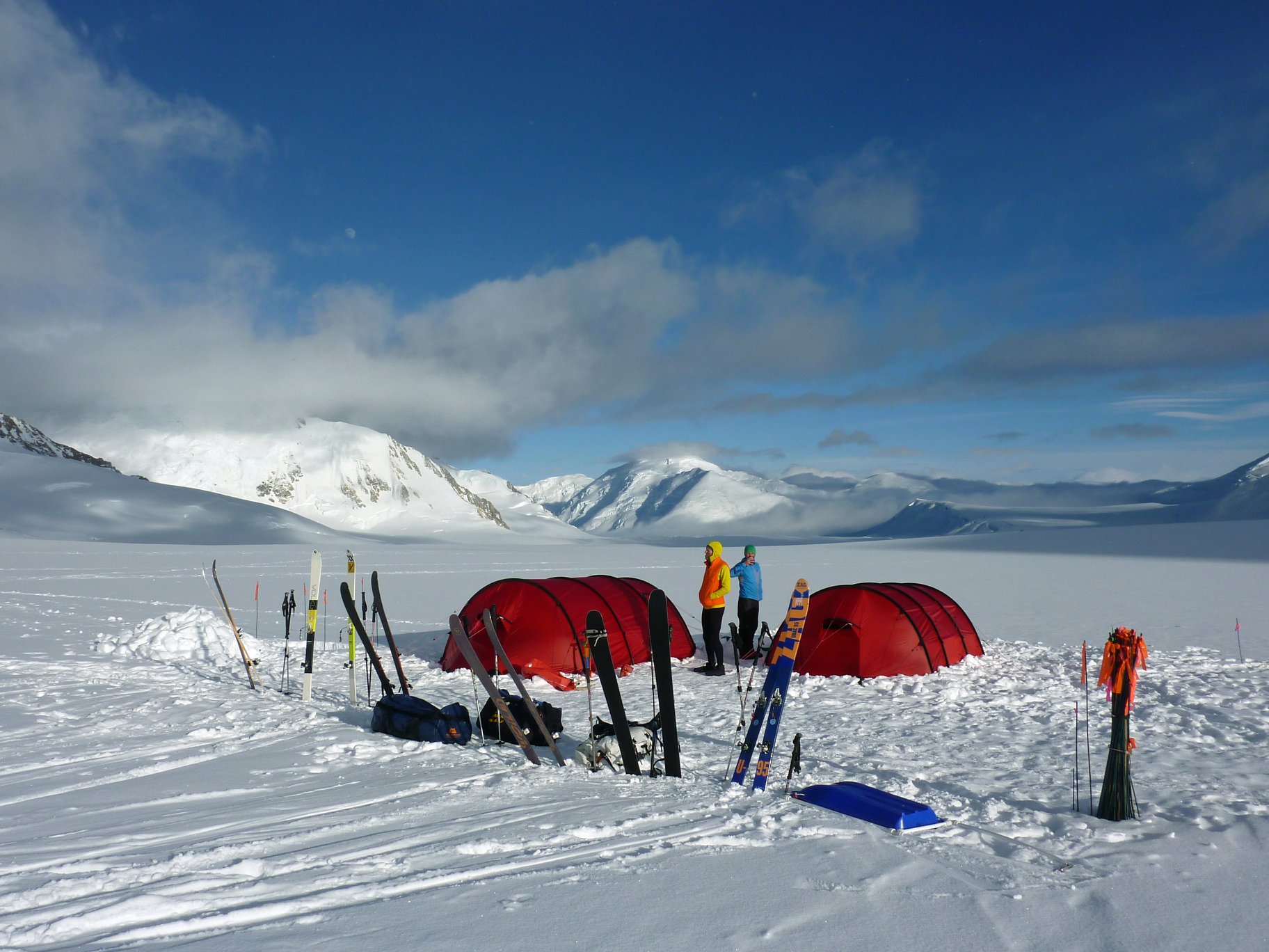
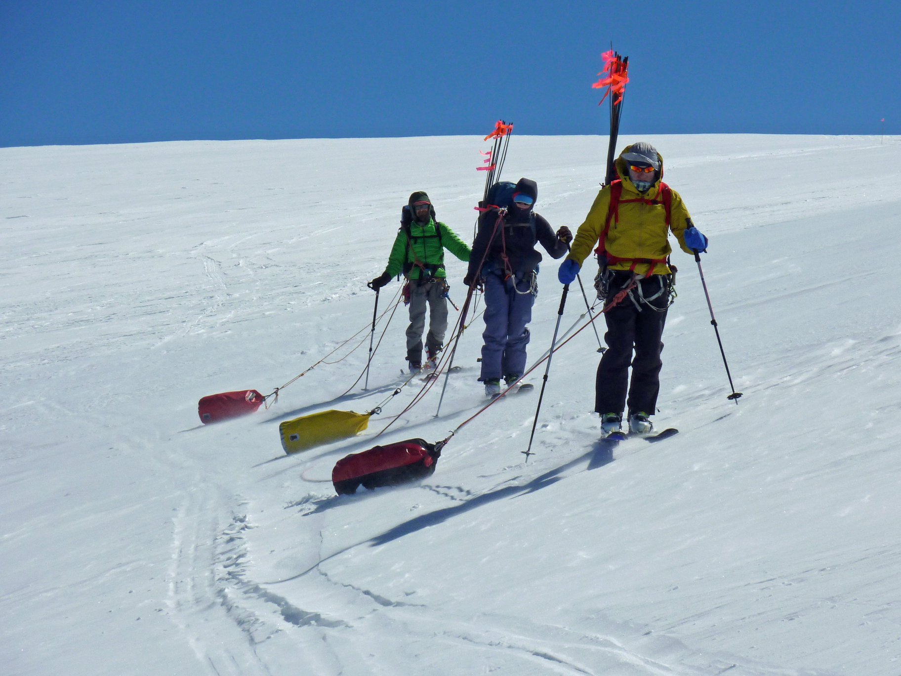
We had also intended Mt Walsh (4507m) as an acclimatisation peak, but the low-snow winter had left it looking rather serious. This meant that to acclimatise further, we needed to move up the glacier towards Steele, so over the following two days, in decreasing visibility ‘Are we in Scotland?’, we moved our supplies and camp 8km up the glacier to 3500m, using haul-bags or sledges to ease the load carrying.
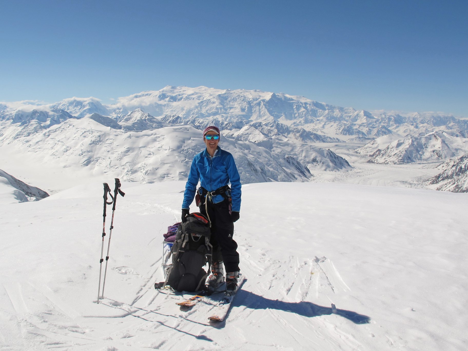
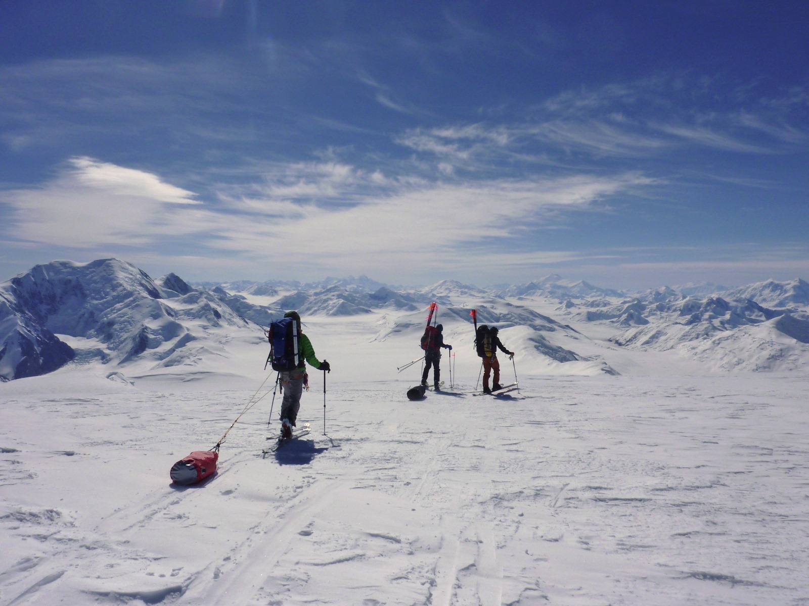
From now on, the weather teased us. Our weather forecasts came from two sources to Garmin Inreaches; they frequently disagreed, both with each other, and with how it actually turned out. We didn’t have that much terrible, blowing-a-hoolie weather but plenty of claggy, white-room days which made it hard to do much on an unknown glacier with sketchy maps. We spent the next few days exploring Mt SE Steele (4280m) and working out how best to get past this subsidiary summit in order to set up a final camp for the launching-off point for the main face of Mt Steele itself. Despite looking for a lower-level route, we had to travel right over the subsidiary summit.
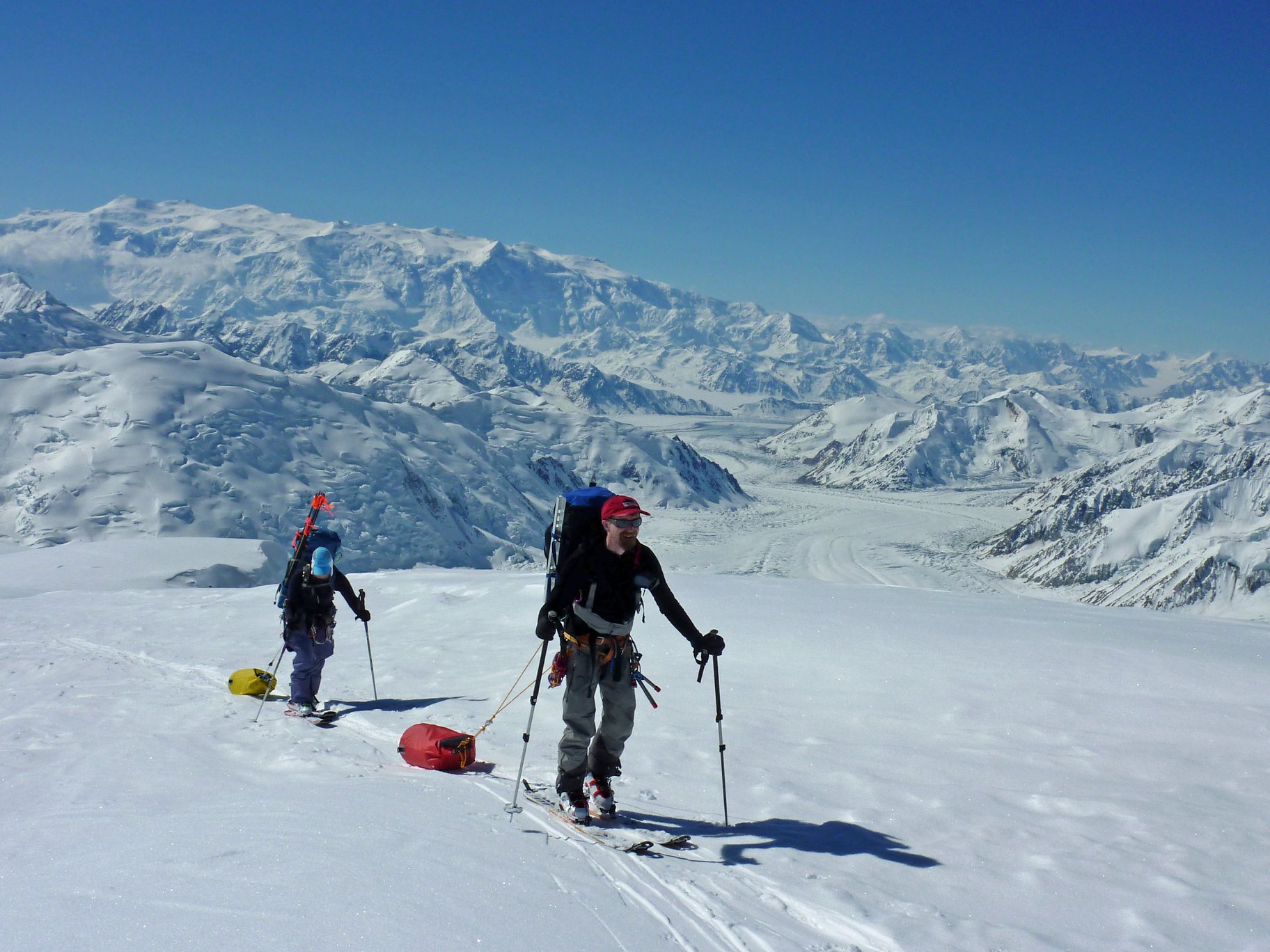
The day we moved was magnificent and from SE Steele, we had some of the most impressive views of the trip; we could see the vast Mt Logan plateau, the Mt Lucania ridge as well as the now completely impassable original ascent route taken by Bradford Washburn. These amazing views were a welcome distraction from trying to perfect the awkward art of skinning a traversing line while pulling a loaded haul-bag.
With a concentrated digging effort, we dug in to establish the highest camp at 3870m, locating it on the East side of the col, given that westerly winds were forecast; a decision we may regret….


From afar we had been trying to work out whether the face of Mt Steele was going to be possible; from what we could see, it all looked rather blue. The only way to find out was to go and investigate, so with what we thought was a three-day weather window, we headed out to take a closer look and acclimatise some more, with the intention of pushing for the summit the following day, if it looked as though it would go. Moving cautiously through a landscape sculpted into huge cornices and littered with crevasses, we were able to find a way through to a col at 4000m. Here we sat on a giant sastrugi as a bench and looked up. The final 1000m-high face of Mt Steele was covered with sheets of blue ice on the lower section of the route, and we reached the dismal conclusion that we were going no further; what our research had led us to believe was mostly a ski peak turned out to be a serious piece of climbing in the current conditions. It is hard to know whether this was due to a low-snow year or broader changes in the weather patterns; it would have needed at least another 2-3m of snow to have made a ski ascent viable.
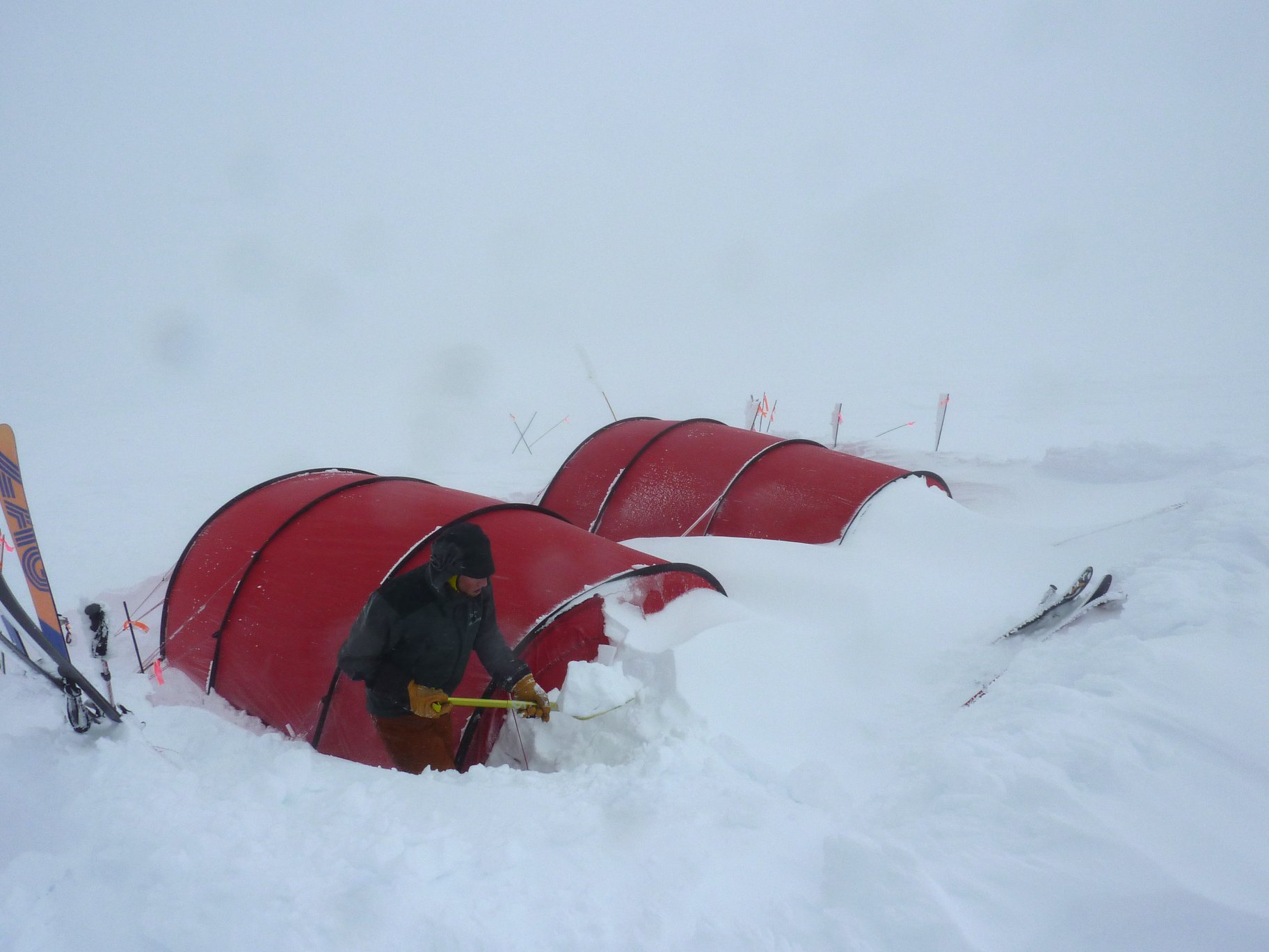
Having regrettably made this decision, we returned to camp, sometimes getting a foot into a crevasse, but making it back without serious incident. That afternoon, contrary to the forecast, the weather turned; it began to snow, the wind moved to the east and strengthened considerably, so our westerly protection walls became giant snow-traps which we struggled to clear. The storm continued overnight and into the next day as we lay in our sleeping bags, trying to push away thoughts of the legendary seven-day storms that can happen here. Suddenly, after 24 hours, the storm subsided, and gave way to an astonishingly clear evening.
It was then time to return to our basecamp, where the plane had dropped us off. Up and over Mt SE Steele (again!); descending the steeper section we had to choose between allowing our haul-bags to chase us like a recalcitrant collie, carrying them like a shopping bag, or strapping them to our packs. Then a long skin down the glacier, as there was insufficient gradient to ski. Some of the team enjoyed this slightly-gravity-assisted, nearly-flat skinning, others could be heard muttering curses under their breath that included the words ‘Never again…’ It was a beautiful day, and we covered the 16km in around 5 hours.
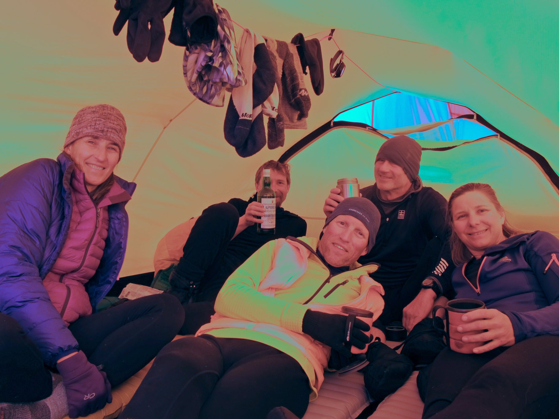
Now that we had decided to call in the plane to pick us up, it was perhaps inevitable that the weather wouldn’t cooperate. We found ourselves in the white-room, more or less tent-bound for the next three days, which is a challenge in itself. We spent much time sleeping, eating up whatever food we had, including the endless chocolate that kept appearing from Susie’s food bag, brewing and chatting. Having called to say we were ready on Saturday, we were picked up on Wednesday and able to go directly to Whitehorse where a chair to sit in, fresh food and the inevitable beer were very welcome.A strong and harmonious team had a great adventure in a remote, impressive mountain area; we were somewhat unfortunate with the conditions and weather. But isn’t part of the point of an adventure, that you don’t know how it’s going to turn out?
The team thanks the ESC and Austrian Alpine Club for their support


